
Where Is Highway 285 in Colorado?
If you’ve ever asked “Where is 285 in Colorado?”, you’re not alone. U.S. Highway 285 (often called simply “285”) is one of Colorado’s most scenic and versatile highways. Stretching roughly 264 miles, it runs north to south through the state, beginning at the New Mexico border and ending in Denver.
Along the way, it passes through breathtaking landscapes—from wide, open valleys and agricultural plains to winding mountain passes and high-altitude towns. Whether you’re a traveler seeking scenic routes or a local navigating between the mountains and metro Denver, Highway 285 is a vital and picturesque roadway.
Route Overview
From the New Mexico Border to the San Luis Valley
Highway 285 enters Colorado just south of Antonito in Conejos County. It continues north through the San Luis Valley, one of the state’s largest agricultural regions. Along this stretch, the highway passes through La Jara, Alamosa, and Monte Vista—towns known for their farms, open skies, and views of the Sangre de Cristo Mountains.
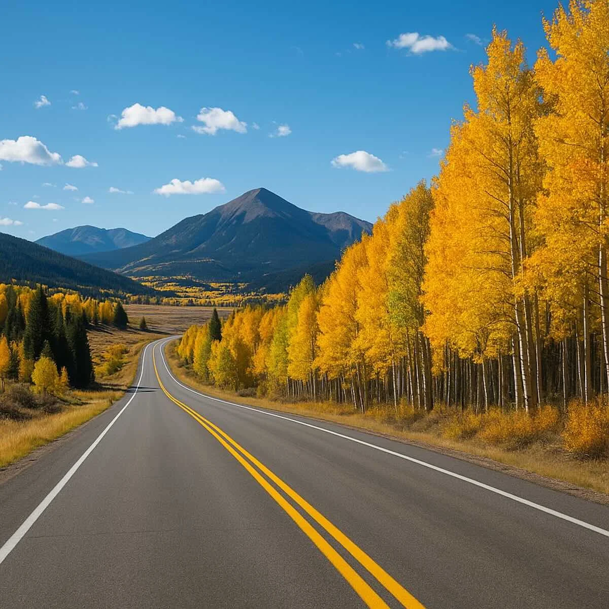
Over the Mountain Passes and Through South Park
Leaving the San Luis Valley, Highway 285 climbs into the Rocky Mountains, crossing a series of scenic and high-altitude passes:
Poncha Pass – Elevation 9,010 ft
Trout Creek Pass – Elevation 9,346 ft
Red Hill Pass – Elevation 9,993 ft
Kenosha Pass – Elevation 10,000 ft
After the climbs, the road opens into South Park, a vast mountain basin dotted with ranches and small communities like Fairplay and Jefferson. This section offers panoramic views and frequent wildlife sightings.
Into the Denver Metro Area
From the high mountain valleys, Highway 285 descends into the foothills of the Front Range. As you approach the Denver metropolitan area, the road becomes a major commuter route. Passing through towns like Bailey, Conifer, and Morrison, the highway transitions from a two-lane mountain road to a multi-lane expressway. It officially ends where it meets Interstate 25 in Denver, near the city’s core.
Key Landmarks and Features Along 285
San Luis Valley: Expansive farmland and stunning views surrounded by mountain ranges.
Poncha Pass & Kenosha Pass: Two of the most scenic drives in Colorado.
South Park Basin: High-mountain plateau known for open skies and quiet roads.
Denver Foothills: Gateway to urban Colorado with quick access to trails and mountain towns.
Why Highway 285 Matters
Highway 285 isn’t just a route—it’s a journey through Colorado’s changing geography. Here’s why it’s so important:
Connectivity: Links southern Colorado communities to Denver and the Front Range.
Tourism: Offers one of the most scenic drives for travelers heading to mountain destinations like Buena Vista, Fairplay, and Breckenridge.
Commuting: Serves as a vital route for residents of foothill communities.
Adventure Access: Provides gateways to hiking, skiing, and camping areas across the Rockies.
Example Drive: From Alamosa to Denver
If you drive north from Alamosa to Denver, you’ll experience nearly every Colorado landscape:
Start in the open plains of the San Luis Valley.
Climb through Poncha Pass toward Salida.
Continue over Trout Creek Pass into South Park.
Cross Kenosha Pass for sweeping mountain views.
Descend into Conifer and Morrison, then into Denver’s urban landscape.
This trip showcases why U.S. 285 is beloved by both locals and road-trippers—it captures the full beauty of Colorado in one route.
Conclusion
So, where is Highway 285 in Colorado? It’s the road that connects the southern valleys to the northern cities, crossing mountain passes and open parks along the way. From Antonito to Denver, this 264-mile stretch of highway offers some of the most diverse and memorable drives in the state.
Whether you’re planning a weekend getaway or a scenic road trip, Highway 285 is a quintessential Colorado experience.
FAQ
Q: How long is Highway 285 in Colorado?
A: It spans about 264 miles, from the New Mexico border to Interstate 25 in Denver.
Q: Is Highway 285 a safe road to drive in winter?
A: It can be challenging in snowy or icy conditions, especially through mountain passes. Drivers should check weather and road conditions before traveling.
Q: What are the most scenic parts of Highway 285?
A: The stretches through South Park, Kenosha Pass, and Poncha Pass are considered among the most beautiful in Colorado.